

MEGALITHIC MONUMENTS
OF IRELAND.COM
OF IRELAND.COM
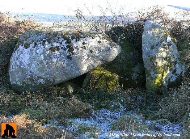
| BROOMFIELDS PORTAL TOMB |
| This portal tomb, marked as 'Cromlech' on the 1910 edition of the OS maps, is located in good flat pasture, on a very gentle SW-facing slope, incorporated into a relatively modern field boundary, 1.5km NW of the village of Donard (*Dún Ard meaning ‘high fort’), north of the L4317 off the N81. The River Carriggower, a minor tributary of the River Slaney (*Abhainn na Sláine, meaning 'river of health'), is 0.50km to the west, with the imposing Lugnaquilla Mountain (*Log na Coille meaning 'hollow of the wood') to the SE. The tomb, with it's entrance facing NNE, consists of a small chamber, 1.9m in length by 1.4m in width, which is formed by a gable-shaped back- stone 1.9m in height and 1.8m in width and a single upright portal stone measuring 2m in height and 1.3m in width. The huge capstone which has fallen forward along with the other portal stone, measures 3.5m in length, 3m in width and 1.5m in depth. The tomb lies between 600 & 700 foot contours (Ó Nualláin, p.84). No trace of a cairn or mound, if there was any, remains. Sources: Ó Nualláin, Seán: 'Irish Portal Tombs: Topography, Siting and Distribution' (JRSAI Vol. 113, 1983) * Placenames Database of Ireland 2016 |
| CO-ORDINATES 53°01'40.3"N 6°37'32.5"W |